
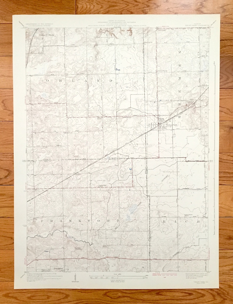


Antique Tinley good Park, Illinois 1929 US Geological Survey Topographic Map - Chicago Suburbs, Orland, Bremen, Rich, Frankfort, Goeselville, IL
Beautiful, antique map of Tinley Park, Illinois and surrounding Cook & Will County area south of Chicago. This is an authentic 1929 print from the U.S. Geological Survey and NOT a computer reproduction.
See what Illinois looked like over 90 years ago. Lots of intricate details and geological contours. Map even has little squares for every house that existed at the time. The USGS cartographers were very thorough back then! good On the back is a description of topographic symbols and map guide.
Perfect for the historian, map-lover, the curious or just as a conversation starter. Wonderful and rare. Maps such as these make great gifts.
Edition of 1929, printed 1929
Dimensions: 19 1/4" width x 25 1/2" height
This is one of the rare oversized maps printed by the USGS.
----
Features
Cities & Towns: Orland, Bremen, Frankfort, Rich, Orland Park, Orland Hills, Goeselville, Summit, Tinley Park.
Points of Interest: Cook County, Will County, Chicago Suburbs, Hickory Creek, Flossmoor Road, Old Indian Boundary, Orland Church, Summit Hill School, Chicago Rock Island and Pacific Railroad, Lincoln State Highway, Butterfield Creek, Vollmer Road, Oak Forest Avenue and lots more hills, brooks, towns, schools, churches, roads and train tracks.
Condition: Very Good Vintage condition, commensurate with age. This map is in incredible shape for being over 90 years old. Light wear and toning but this will add to vintage character when framed.
----
We will happily adjust shipping price for multiple purchases. Maps are rolled up and shipped in sturdy mailing tubes, never folded.